![](/images/other/stat-length.png)
![Randonnée Marche Les Hautes-Rivières - Ravin des ours - Photo](https://media.geolcdn.com/t/1900/400/ext.pjpeg?maxdim=2&url=https%3A%2F%2Fstatic1.geolcdn.com%2Fsiteimages%2Fupload%2Ffiles%2F1553511878bg_sport_marche.png)
Ravin des ours
José Cordy
Utilisateur
![Longueur](/images/other/stat-length.png)
Longueur
11,9 km
![Altitude max](https://static1.geolcdn.com/siteimages/upload/files/1508320355ic_sort_altitude_max_24dp.png)
Altitude max
482 m
![Dénivelé positif](https://static1.geolcdn.com/siteimages/upload/files/1508320355ic_sort_den_pos_24dp.png)
Dénivelé positif
281 m
![Km-Effort](/images/other/stat-length.png)
Km-Effort
15,7 km
![Altitude min](https://static1.geolcdn.com/siteimages/upload/files/1508320355ic_sort_altitude_min_24dp.png)
Altitude min
207 m
![Dénivelé négatif](https://static1.geolcdn.com/siteimages/upload/files/1508320355ic_sort_den_neg_24dp.png)
Dénivelé négatif
281 m
![Boucle](https://static1.geolcdn.com/siteimages/upload/files/16400158638029165_repeat_loop_refresh_sync_direction_icon.png)
Boucle
Oui
Date de création :
2020-07-21 12:37:07.246
Dernière modification :
2020-07-21 19:36:56.932
![Marche](https://static1.geolcdn.com/sitytour/trail-icons/101.png)
3h10
Difficulté : Moyen
![Scannez ce code QR pour ouvrir la randonnée dans l'application SityTrail](https://capi.geolives.com/qq0zvz2zws4bq2lad0pu/sitytour/trails/2485075/qr.png?size=200)
Application GPS de randonnée GRATUITE
À propos
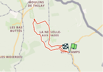
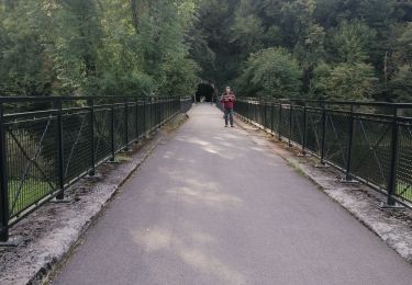
Randonnée Marche de 11,9 km à découvrir à Grand Est, Ardennes, Les Hautes-Rivières. Cette randonnée est proposée par José Cordy.
Description
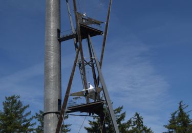
Linchamps - La Neuville aux Haies - Ravin des jours- Linchamps
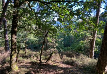
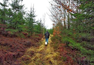
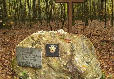
Superbe promenade dans une splendide région boisée aux authentiques petits villages
Localisation
Pays :
France
Région :
Grand Est
Département/Province :
Ardennes
Commune :
Les Hautes-Rivières
Localité :
Unknown
Départ:(Dec)
Départ:(UTM)
631874 ; 5530406 (31U) N.
Commentaires
Randonnées à proximité
![Marche Marche](https://static1.geolcdn.com/sitytour/trail-icons/101.png)
RB-Na-30_Croix-Scaille
Marche
Très difficile
(3)
Gedinne,
Wallonie,
Namur,
Belgique
![](/images/other/stat-length.png)
23 km | 30 km-effort
6h 47min
![](https://static1.geolcdn.com/siteimages/upload/files/16400158638029165_repeat_loop_refresh_sync_direction_icon.png)
Oui
![Randonnée Marche Gedinne - Gedinne - Circuit Natura 2000](https://media.geolcdn.com/t/375/260/ext.jpg?maxdim=2&url=https%3A%2F%2Fservices.sitytrail.com%2FGeolivesWS%2FDownloadMedia.ashx%3FTrailID%3D472278%26Media%3Dd7fd7a8f-ff34-456c-92bf-c54889e59e75.jpg)
![Marche Marche](https://static1.geolcdn.com/sitytour/trail-icons/101.png)
Gedinne - Circuit Natura 2000 "des sites qui valent le détour" - Na10
Marche
Moyen
(3)
Gedinne,
Wallonie,
Namur,
Belgique
![](/images/other/stat-length.png)
9 km | 11,9 km-effort
1h 30min
![](https://static1.geolcdn.com/siteimages/upload/files/16400158638029165_repeat_loop_refresh_sync_direction_icon.png)
Non
![Randonnée Marche Les Hautes-Rivières - Hautes Rivières Roches aux Corpias 24,8 - Photo](https://media.geolcdn.com/t/375/260/1bced7d6-1689-4307-97c5-abccba35c800.jpg&format=jpg&maxdim=2)
![Marche Marche](https://static1.geolcdn.com/sitytour/trail-icons/101.png)
Hautes Rivières Roches aux Corpias 24,8
Marche
Difficile
Les Hautes-Rivières,
Grand Est,
Ardennes,
France
![](/images/other/stat-length.png)
25 km | 39 km-effort
8h 34min
![](https://static1.geolcdn.com/siteimages/upload/files/16400158638029165_repeat_loop_refresh_sync_direction_icon.png)
Oui
![Randonnée Marche Gedinne - Balade à la Croix-Scaille - Les Fanges de l'Abîme - Photo](https://media.geolcdn.com/t/375/260/90477e17-0e05-4a6f-bcf1-b60967f06656.jpeg&format=jpg&maxdim=2)
![Marche Marche](https://static1.geolcdn.com/sitytour/trail-icons/101.png)
Balade à la Croix-Scaille - Les Fanges de l'Abîme
Marche
Moyen
(2)
Gedinne,
Wallonie,
Namur,
Belgique
![](/images/other/stat-length.png)
6,6 km | 8,7 km-effort
1h 58min
![](https://static1.geolcdn.com/siteimages/upload/files/16400158638029165_repeat_loop_refresh_sync_direction_icon.png)
Oui
![Randonnée Marche Gedinne - Espace liberté 44 - Photo](https://media.geolcdn.com/t/375/260/bba44172-4661-46c9-9ee8-3e242016800f.jpg&format=jpg&maxdim=2)
![Marche Marche](https://static1.geolcdn.com/sitytour/trail-icons/101.png)
Espace liberté 44
Marche
Très facile
Gedinne,
Wallonie,
Namur,
Belgique
![](/images/other/stat-length.png)
5,5 km | 6,7 km-effort
1h 15min
![](https://static1.geolcdn.com/siteimages/upload/files/16400158638029165_repeat_loop_refresh_sync_direction_icon.png)
Oui
![Marche Marche](https://static1.geolcdn.com/sitytour/trail-icons/101.png)
RB-Na-30_Croix-Scaille_via-racc
Marche
Très difficile
Gedinne,
Wallonie,
Namur,
Belgique
![](/images/other/stat-length.png)
17,1 km | 22 km-effort
5h 4min
![](https://static1.geolcdn.com/siteimages/upload/files/16400158638029165_repeat_loop_refresh_sync_direction_icon.png)
Oui
![Randonnée Marche Thilay - monthermé - tour du milénaire (2 jours) - Photo](https://media.geolcdn.com/t/375/260/ext.jpg?maxdim=2&url=https%3A%2F%2Fstatic1.geolcdn.com%2Fsiteimages%2Fupload%2Ffiles%2F1553511878bg_sport_marche.png)
![Marche Marche](https://static1.geolcdn.com/sitytour/trail-icons/101.png)
monthermé - tour du milénaire (2 jours)
Marche
Moyen
(1)
Thilay,
Grand Est,
Ardennes,
France
![](/images/other/stat-length.png)
40 km | 59 km-effort
11h 59min
![](https://static1.geolcdn.com/siteimages/upload/files/16400158638029165_repeat_loop_refresh_sync_direction_icon.png)
Oui
![Randonnée Marche Vresse-sur-Semois - Rando au départ de Bohan - Photo](https://media.geolcdn.com/t/375/260/1e11a37e-ac41-474a-a44c-94b180dd0ba8.jpg&format=jpg&maxdim=2)
![Marche Marche](https://static1.geolcdn.com/sitytour/trail-icons/101.png)
Rando au départ de Bohan
Marche
Très difficile
Vresse-sur-Semois,
Wallonie,
Namur,
Belgique
![](/images/other/stat-length.png)
26 km | 37 km-effort
6h 13min
![](https://static1.geolcdn.com/siteimages/upload/files/16400158638029165_repeat_loop_refresh_sync_direction_icon.png)
Oui
![Randonnée Marche Gedinne - rando croix scaille 26-12-2023 - Photo](https://media.geolcdn.com/t/375/260/b3e1e0f4-4e13-454b-a310-d71ac4c74c32.jpg&format=jpg&maxdim=2)
![Marche Marche](https://static1.geolcdn.com/sitytour/trail-icons/101.png)
rando croix scaille 26-12-2023
Marche
Moyen
Gedinne,
Wallonie,
Namur,
Belgique
![](/images/other/stat-length.png)
8,5 km | 10,4 km-effort
2h 18min
![](https://static1.geolcdn.com/siteimages/upload/files/16400158638029165_repeat_loop_refresh_sync_direction_icon.png)
Oui
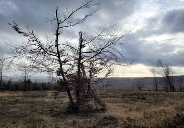
très belle promenade mais le dénivelé est assez important...